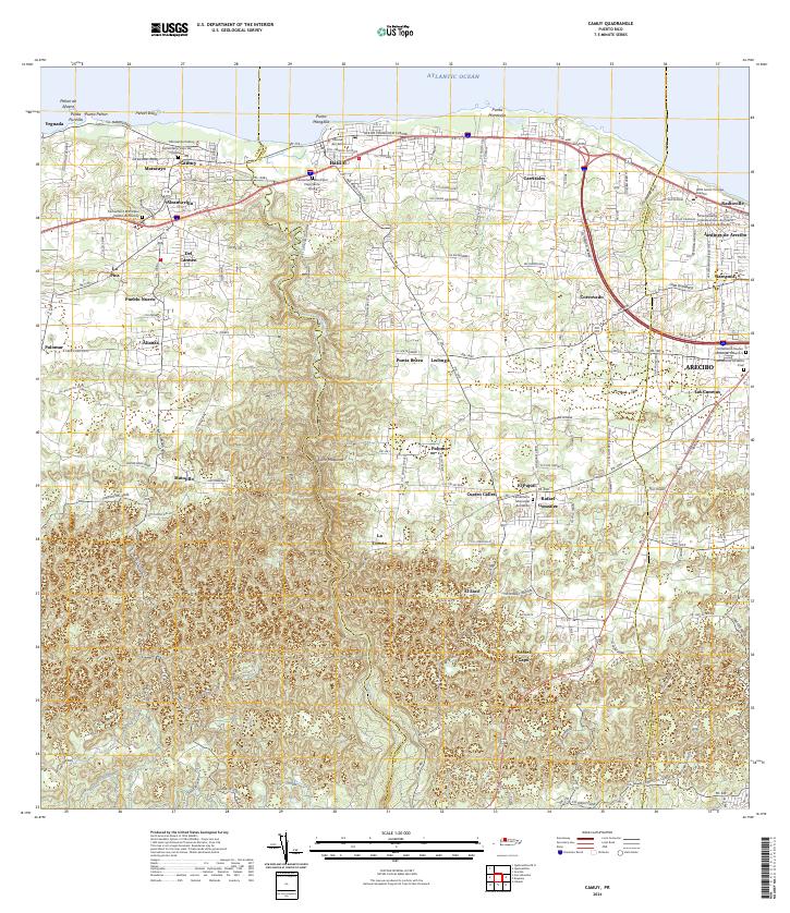
2024 Map of Camuy
USGS Topo · Published 2024About this map
Maracayo and Camuy anchor the coastal fringe of this northern Puerto Rican landscape, where the Atlantic shoreline meets the rising foothills of the Montañas Guarionex. The map traces the winding course of the Rio Camuy as it carves through the karst terrain, passing the Salto Máquina and separating the municipal districts. Historically significant sites for genealogists include a high density of burial grounds, such as the Cementerio Viejo de Camuy and the Cementerio Municipal Viejo Santa Rosa, which reflect generations of local settlement patterns.
Find a feature on this map
54 named features on this map. Tap any name to fly to it.
Don’t see what you’re looking for? This feature index may not catch every label — zoom into the map to look around manually.
Map Details
Editions of this 2024 Camuy Map
This is the sole edition of this map. No revisions or reprints were ever made.
Other maps of this area

1938 · Camuy
USGS Topo · 1:20,000

1938 · San Sebastian
USGS Topo · 1:20,000

1938 · Quebradillas
USGS Topo · 1:20,000

1941 · San Sebastian
USGS Topo · 1:30,000

1942 · Arecibo
USGS Topo · 1:30,000

1942 · Camuy
USGS Topo · 1:30,000

1946 · Utuado
USGS Topo · 1:30,000

1946 · Bayaney
USGS Topo · 1:30,000

1946 · Arecibo
USGS Topo · 1:30,000
1947 · Arecibo SO
USGS Topo · 1:10,000