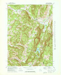
1973 Map of Canaan
USGS Topo · Published 1978About this map
Kinderhook Creek and Wyomanock Creek define the landscape of this area on the New York and Massachusetts border during the 1970s. The valley floors are bustling with historic settlements like New Lebanon, West Lebanon, and New Lebanon Center, which are interconnected by the Penn Central railroad and the New York Thruway. The presence of institutions such as the Berkshire Farm For Boys and both the New Lebanon Sch and Mt Lebanon Sch indicates a well-established community infrastructure. To the south, Canaan and Canaan Center sit near the recreational and natural landmarks of Queechy Lake and the steep terrain of Rattlesnake Den. The eastern edge of the map transition into the high ridges of Hancock, Massachusetts, where Perry Peak towers over the border. Local history is deeply etched into the land here, from the Shaker Swamp to the Cemetery of the Evergreens.
Find a feature on this map
47 named features on this map. Tap any name to fly to it.
Don’t see what you’re looking for? This feature index may not catch every label — zoom into the map to look around manually.
Map Details
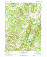
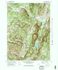
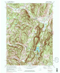
Editions of this 1973 Canaan Map
4 editions found
Other maps of this area

1888 · Berlin
USGS Topo · 1:62,500

1888 · Pittsfield
USGS Topo · 1:62,500

1890 · Pittsfield
USGS Topo · 1:62,500

1890 · Berlin
USGS Topo · 1:62,500

1893 · Troy
USGS Topo · 1:62,500

1893 · Pittsfield
USGS Topo · 1:62,500

1894 · Berlin
USGS Topo · 1:62,500

1894 · Pittsfield
USGS Topo · 1:62,500

1895 · Troy
USGS Topo · 1:62,500

1897 · Pittsfield
USGS Topo · 1:62,500