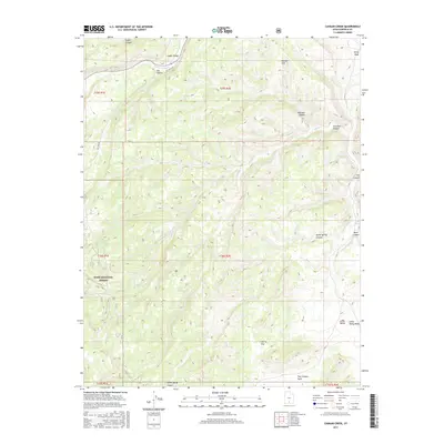
2017 Map of Canaan Creek
USGS Topo · Published 2017About this map
Dixie National Forest covers much of this high-elevation landscape in Garfield County, where the topography is defined by a complex network of canyons and washes. The northern portion is characterized by Upper Valley and the course of Upper Valley Cr, leading toward the geological landmark Horizon Arch. The terrain reveals a rugged series of drainages, including Mitchell Canyon, Coal Bed Canyon, and Calf Canyon, which transition into broader areas like Cherry Flat and Little Valley to the south. This 2017 survey details a landscape where traditional water management is evident through various stock ponds and the drainage of Canaan Creek and Willow Creek. The map is an essential reference for understanding the remote land-use patterns and natural features within the public lands of southern Utah.
Find a feature on this map
24 named features on this map. Tap any name to fly to it.
Don’t see what you’re looking for? This feature index may not catch every label — zoom into the map to look around manually.
Map Details
Editions of this 2017 Canaan Creek Map
This is the sole edition of this map. No revisions or reprints were ever made.
Other maps of this area

1886 · Escalante
USGS Topo · 1:250,000

1956 · Escalante
USGS Topo · 1:250,000

1960 · Escalante
USGS Topo · 1:250,000

1964 · Griffin Point
USGS Topo · 1:24,000

1964 · Dave Canyon
USGS Topo · 1:24,000

1964 · Canaan Creek
USGS Topo · 1:24,000

1964 · Canaan Peak
USGS Topo · 1:24,000

1964 · Death Ridge
USGS Topo · 1:24,000

1964 · Carcass Canyon
USGS Topo · 1:24,000
1964 · Wide Hollow Reservoir
USGS Topo · 1:24,000