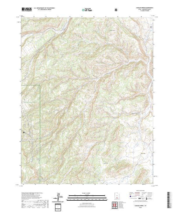
2023 Map of Canaan Creek
USGS Topo · Published 2023About this map
Dixie National Forest encompasses much of this high-altitude terrain in Garfield County, where deep incisions like Mitchell Canyon and Coal Bed Canyon define the drainage patterns of the Colorado Plateau. The landscape is marked by unique geologic formations such as Horizon Arch, situated near the head of Upper Valley. Water, though sparse, dictates the geography here, with seasonal drainages including Alvey Wash and the eponymous Canaan Creek carving paths through the plateau. Significant flats and clearings like Cherry Flat and Little Valley offer breaks in the complex network of canyons and hollows, such as Pet Hollow and Calf Canyon. This modern survey details a region defined by its natural landmarks and traditional cattle-grazing grounds rather than dense settlement, providing a look at the area's contemporary land management and topographical character.
Find a feature on this map
15 named features on this map. Tap any name to fly to it.
Don’t see what you’re looking for? This feature index may not catch every label — zoom into the map to look around manually.
Map Details
Editions of this 2023 Canaan Creek Map
This is the sole edition of this map. No revisions or reprints were ever made.
Other maps of this area

1886 · Escalante
USGS Topo · 1:250,000

1956 · Escalante
USGS Topo · 1:250,000

1960 · Escalante
USGS Topo · 1:250,000

1964 · Griffin Point
USGS Topo · 1:24,000

1964 · Dave Canyon
USGS Topo · 1:24,000

1964 · Canaan Creek
USGS Topo · 1:24,000

1964 · Canaan Peak
USGS Topo · 1:24,000

1964 · Death Ridge
USGS Topo · 1:24,000

1964 · Carcass Canyon
USGS Topo · 1:24,000
1964 · Wide Hollow Reservoir
USGS Topo · 1:24,000