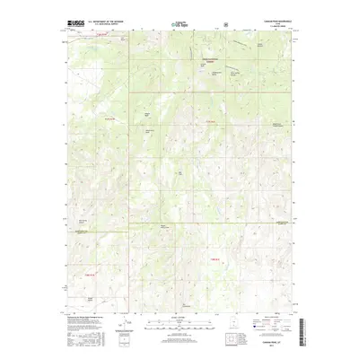
2017 Map of Canaan Peak
USGS Topo · Published 2017About this map
Canaan Peak and Kaiparowitz Peak dominate this high-elevation landscape within the Dixie National Forest along the border of Garfield and Kane counties. The topography is defined by dramatic erosional features like The Blues and the sharp ridge of The Cockscomb, illustrating the complex geology of the Grand Staircase region. Movement through this backcountry is traced via the Canaan Mountain Trail, which skirts Canaan Bottom and Headquarters Valley.
Find a feature on this map
30 named features on this map. Tap any name to fly to it.
Don’t see what you’re looking for? This feature index may not catch every label — zoom into the map to look around manually.
Map Details
Editions of this 2017 Canaan Peak Map
This is the sole edition of this map. No revisions or reprints were ever made.
Other maps of this area

1886 · Escalante
USGS Topo · 1:250,000

1922 · Upper Last Chance
USGS Topo · 1:63,360

1956 · Escalante
USGS Topo · 1:250,000

1960 · Escalante
USGS Topo · 1:250,000

1964 · Canaan Creek
USGS Topo · 1:24,000

1964 · Canaan Peak
USGS Topo · 1:24,000

1964 · Death Ridge
USGS Topo · 1:24,000

1964 · Henrieville
USGS Topo · 1:24,000
1964 · Pine Lake
USGS Topo · 1:24,000
1964 · Butler Valley
USGS Topo · 1:24,000