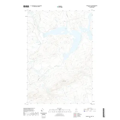
2021 Map of Canada Falls Lake
USGS Topo · Published 2021About this map
Canada Falls Lake dominates the upper portion of this Somerset County landscape, where the South Branch Penobscot River feeds into its western waters. The topography is defined by the significant rise of Ironbound Mtn to the south, surrounded by a complex network of wetlands and smaller water bodies including Beaver Pond and the Trickey Ponds. Navigation through this forested terrain is limited to a few specific corridors such as Alder Brook Rd and Cunningham Rd, which trace the drainage patterns of the region's numerous brooks. The hydrography of the southern slopes is shaped by the headwaters of the S Br Brassua Stream, illustrating the divide between the Penobscot and Brassua watersheds. This area of Thorndike Township remains largely undeveloped, characterized by timberlands and a high density of named brooks like Hale Brook and Fish Brook.
Find a feature on this map
14 named features on this map. Tap any name to fly to it.
Don’t see what you’re looking for? This feature index may not catch every label — zoom into the map to look around manually.
Map Details
Editions of this 2021 Canada Falls Lake Map
This is the sole edition of this map. No revisions or reprints were ever made.
Other maps of this area

1921 · Brassua Lake
USGS Topo · 1:62,500

1922 · Long Pond
USGS Topo · 1:62,500

1923 · Brassua Lake
USGS Topo · 1:62,500

1924 · Long Pond
USGS Topo · 1:62,500

1944 · Brassua Lake
USGS Topo · 1:62,500

1944 · Long Pond
USGS Topo · 1:62,500

1949 · Jackman
USGS Topo · 1:250,000

1954 · Seboomook Lake
USGS Topo · 1:62,500

1954 · Millinocket
USGS Topo · 1:250,000

1956 · Penobscot Lake
USGS Topo · 1:62,500
Featured Places
- Thorndike Township, ME
- Alder Brook Township, ME
- Pittston Academy Grant, ME
- Hammond Township, ME
- Soldiertown Township, ME