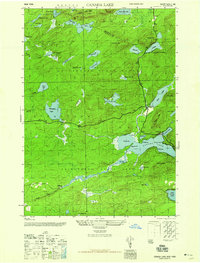
1946 Map of Canada Lake
USGS Topo · Published 1946About this map
Adirondack State Park dominates this mid-century landscape where Hamilton and Fulton Counties meet. The southern portion of Arietta and the northern reaches of Stratford and Caroga are defined by a complex network of glacial water bodies, from the prominent Canada Lake and West Lake to the secluded Broomstick Lake and Nine Corner Lake. Evidence of early industrial and recreational activity is visible at Waters Millpond and the settlement of Stewart Landing along Sprite Creek. High points like Kane Mtn and Rooster Hill overlook a terrain marked by numerous vlys and ponds, including Tamarack Vly and the Spectacle Lakes. This survey shows the region just after the war, detailing the footpaths and secondary roads that connected these shorelines before more modern development altered the remote character of the southern Adirondacks.
Find a feature on this map
47 named features on this map. Tap any name to fly to it.
Don’t see what you’re looking for? This feature index may not catch every label — zoom into the map to look around manually.
Map Details
Editions of this 1946 Canada Lake Map
2 editions found
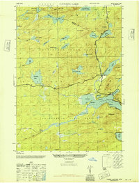
Other maps of this area

1901 · Lassellsville
USGS Topo · 1:62,500

1903 · Gloversville
USGS Topo · 1:62,500

1903 · Lassellsville
USGS Topo · 1:62,500

1904 · Piseco Lake
USGS Topo · 1:62,500

1906 · Piseco Lake
USGS Topo · 1:62,500

1907 · Lake Pleasant
USGS Topo · 1:62,500

1908 · Piseco Lake
USGS Topo · 1:62,500

1943 · Gloversville
USGS Topo · 1:62,500
1945 · Stratford
USGS Topo · 1:24,000

1945 · Caroga Lake
USGS Topo · 1:24,000