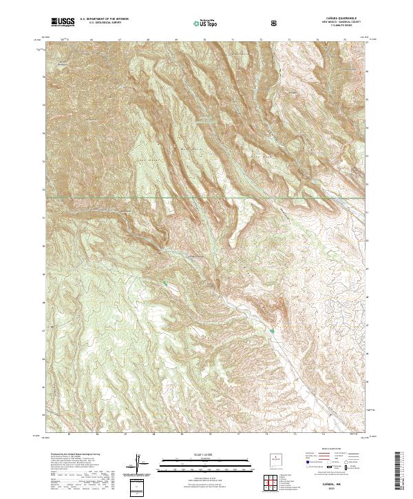
2023 Map of Canada
USGS Topo · Published 2023About this map
Kasha-Katuwe Tent Rocks National Monument dominates the southern portion of this landscape, showcasing the distinct geological formations within the Santa Fe National Forest. The terrain is defined by a series of high mesas and deep drainages, including Oaks Mesa, Cochiti Mesa, and the prominent Bearhead Peak along Bearhead Ridge. This 2023 survey illustrates a wilderness-dominant environment where human infrastructure is largely limited to forest trails and access routes like Indian SVC Rte 92.
Find a feature on this map
36 named features on this map. Tap any name to fly to it.
Don’t see what you’re looking for? This feature index may not catch every label — zoom into the map to look around manually.
Map Details
Editions of this 2023 Canada Map
This is the sole edition of this map. No revisions or reprints were ever made.
Other maps of this area

1890 · Jemes
USGS Topo · 1:125,000

1892 · Jemes
USGS Topo · 1:125,000

1892 · Santa Clara
USGS Topo · 1:125,000

1937 · Jemez Springs
USGS Topo · 1:48,000

1943 · Jemez
USGS Topo · 1:62,500

1944 · Jemez Springs
USGS Topo · 1:62,500

1952 · Jemez Springs
USGS Topo · 1:62,500

1952 · Frijoles
USGS Topo · 1:24,000

1952 · Jemez
USGS Topo · 1:62,500

1953 · Cochiti Dam
USGS Topo · 1:24,000