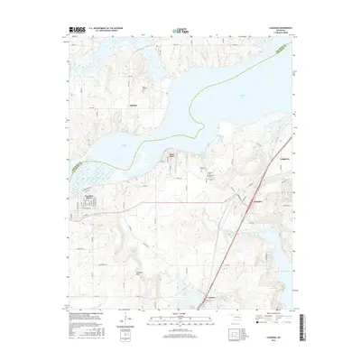
2016 Map of Canadian
USGS Topo · Published 2016About this map
Eufaula Lake dominates this central Oklahoma landscape, where the irregular shoreline of the Canadian River arm creates a series of peninsulas and inlets. The town of Crowder sits near the southern edge, positioned where the terrain rises toward Crowder Mtn. This area reflects a transition between established lakeside settlements like Canadian Shores and the smaller, more dispersed communities of Mellette and Longtown.
Find a feature on this map
40 named features on this map. Tap any name to fly to it.
Don’t see what you’re looking for? This feature index may not catch every label — zoom into the map to look around manually.
Map Details
Editions of this 2016 Canadian Map
This is the sole edition of this map. No revisions or reprints were ever made.
Other maps of this area

1900 · Canadian
USGS Topo · 1:125,000

1946 · Fort Smith
USGS Topo · 1:250,000

1962 · Raiford
USGS Topo · 1:24,000

1963 · Stidham
USGS Topo · 1:24,000

1963 · Eufaula
USGS Topo · 1:24,000

1965 · Fort Smith
USGS Topo · 1:250,000

1967 · Fort Smith
USGS Topo · 1:250,000
1971 · Blocker
USGS Topo · 1:24,000
1971 · Crowder
USGS Topo · 1:24,000
1971 · Canadian
USGS Topo · 1:24,000