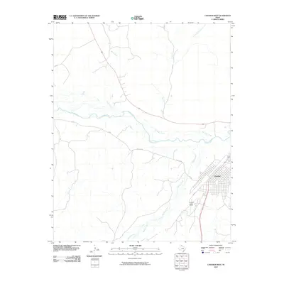
2010 Map of Canadian West
USGS Topo · Published 2010About this map
The city of Canadian serves as the focal point of this High Plains landscape, situated at the confluence of several significant waterways in the Texas Panhandle. The winding path of the Canadian River cuts through the territory, joined by tributaries including Big Timber Creek, Horse Creek, and Red Deer Creek. This 2010 survey illustrates the town's modern footprint, characterized by a structured grid of streets such as Cedar St and its proximity to regional transportation hubs like the Hemphill County Airport. Beyond the immediate residential areas, the terrain is defined by its drainage network, with Simmons Creek and the East Prong Big Timber Creek shaping the topography of the surrounding ranch land. The map provides a clear look at the intersection of rural infrastructure and the river valley geography that has defined this region since its frontier days.
Find a feature on this map
13 named features on this map. Tap any name to fly to it.
Don’t see what you’re looking for? This feature index may not catch every label — zoom into the map to look around manually.
Map Details
Editions of this 2010 Canadian West Map
This is the sole edition of this map. No revisions or reprints were ever made.
Other maps of this area

1954 · Perryton
USGS Topo · 1:250,000

1954 · Amarillo
USGS Topo · 1:250,000

1958 · Perryton
USGS Topo · 1:250,000

1958 · Amarillo
USGS Topo · 1:250,000

1967 · Mendota
USGS Topo · 1:24,000

1967 · Canadian SE
USGS Topo · 1:24,000

1972 · Washburn Arroyo
USGS Topo · 1:24,000

1972 · Canadian West
USGS Topo · 1:24,000

1972 · East Dry Creek
USGS Topo · 1:24,000

1972 · Canadian East
USGS Topo · 1:24,000