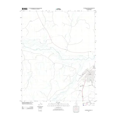
2012 Map of Canadian West
USGS Topo · Published 2012About this map
The town of Canadian sits at the eastern edge of this Panhandle landscape, where the street grid fans out near the banks of the Canadian River. This 2012 survey illustrates the high plains terrain defined by numerous drainage systems, including Big Timber Cr and Red Deer Cr, which carve through the open country. To the southwest of the main settlement, the Hemphill County Airport serves the region, accessed via Airport Rd and Exhibition Rd. The map detail follows the town's residential and commercial growth along thoroughfares like Main St and S Locust St, reaching out toward the expansive river valley. The surrounding rural areas are marked by a network of county roads, such as Co Road F, providing a clear view of the ranching and agricultural land use typical of Hemphill County.
Find a feature on this map
26 named features on this map. Tap any name to fly to it.
Don’t see what you’re looking for? This feature index may not catch every label — zoom into the map to look around manually.
Map Details
Editions of this 2012 Canadian West Map
This is the sole edition of this map. No revisions or reprints were ever made.
Other maps of this area

1954 · Perryton
USGS Topo · 1:250,000

1954 · Amarillo
USGS Topo · 1:250,000

1958 · Perryton
USGS Topo · 1:250,000

1958 · Amarillo
USGS Topo · 1:250,000

1967 · Mendota
USGS Topo · 1:24,000

1967 · Canadian SE
USGS Topo · 1:24,000

1972 · Washburn Arroyo
USGS Topo · 1:24,000

1972 · Canadian West
USGS Topo · 1:24,000

1972 · East Dry Creek
USGS Topo · 1:24,000

1972 · Canadian East
USGS Topo · 1:24,000