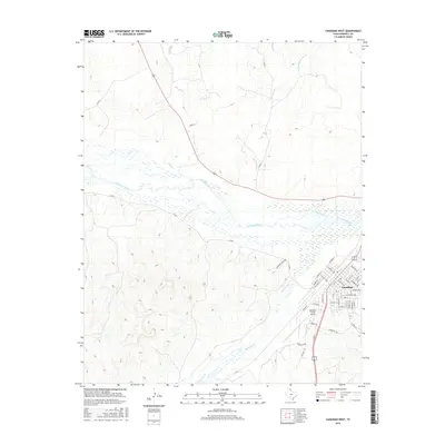
2016 Map of Canadian West
USGS Topo · Published 2016About this map
Canadian serves as the focal point of this Panhandle landscape, where the town layout is defined by a dense grid of streets including College Ave, Houston Ave, and Red Deer St. The town sits at a geographic crossroads just south of the wide, braided corridor of the Canadian River. This waterway and its network of tributaries, such as Horse Cr and Big Timber Cr, dominate the northern half of the sheet, illustrating the importance of natural drainage in the high plains environment. The proximity of the Hemphill County Airport to the western edge of the town center reflects the mid-century development of local aviation infrastructure. Ranching culture is evidenced by the presence of Brainard Ranch Rd winding through the broken terrain south of the river, while the complex contours around Red Deer Cr highlight the transition from the flat plains to the eroded creek valleys that characterize the region.
Find a feature on this map
49 named features on this map. Tap any name to fly to it.
Don’t see what you’re looking for? This feature index may not catch every label — zoom into the map to look around manually.
Map Details
Editions of this 2016 Canadian West Map
This is the sole edition of this map. No revisions or reprints were ever made.
Other maps of this area

1954 · Perryton
USGS Topo · 1:250,000

1954 · Amarillo
USGS Topo · 1:250,000

1958 · Perryton
USGS Topo · 1:250,000

1958 · Amarillo
USGS Topo · 1:250,000

1967 · Mendota
USGS Topo · 1:24,000

1967 · Canadian SE
USGS Topo · 1:24,000

1972 · Washburn Arroyo
USGS Topo · 1:24,000

1972 · Canadian West
USGS Topo · 1:24,000

1972 · East Dry Creek
USGS Topo · 1:24,000

1972 · Canadian East
USGS Topo · 1:24,000