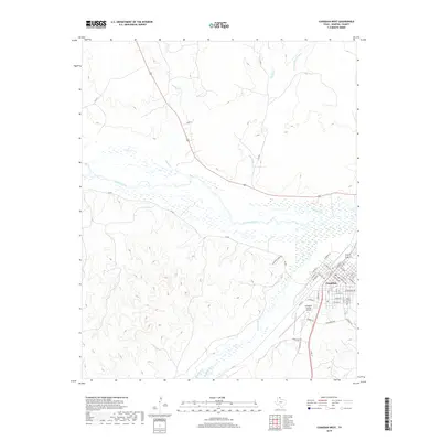
2019 Map of Canadian West
USGS Topo · Published 2019About this map
Canadian occupies the southeastern corner of this Texas Panhandle landscape, where the town sits on a plateau overlooking the wide, braided channel of the Canadian River. This 2019 survey captures the modern street grid of the county seat, stretching from Mobeetie St toward the southern outskirts where the Hemphill County Airport serves the region. The map reveals the intricate drainage system of the High Plains, with numerous waterways like Big Timber Cr and Horse Cr cutting through the topography toward the river valley. The dense network of county roads, including Brainard Ranch Rd and Co RD 1, follows the ridgelines and creek beds, illustrating the intersection of ranching infrastructure and local transport in Hemphill County.
Find a feature on this map
49 named features on this map. Tap any name to fly to it.
Don’t see what you’re looking for? This feature index may not catch every label — zoom into the map to look around manually.
Map Details
Editions of this 2019 Canadian West Map
This is the sole edition of this map. No revisions or reprints were ever made.
Other maps of this area

1954 · Perryton
USGS Topo · 1:250,000

1954 · Amarillo
USGS Topo · 1:250,000

1958 · Perryton
USGS Topo · 1:250,000

1958 · Amarillo
USGS Topo · 1:250,000

1967 · Mendota
USGS Topo · 1:24,000

1967 · Canadian SE
USGS Topo · 1:24,000

1972 · Washburn Arroyo
USGS Topo · 1:24,000

1972 · Canadian West
USGS Topo · 1:24,000

1972 · East Dry Creek
USGS Topo · 1:24,000

1972 · Canadian East
USGS Topo · 1:24,000