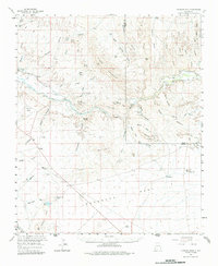
1959 Map of Canador Peak
USGS Topo · Published 1986About this map
The Gila River cuts through this landscape, creating the dramatic geological features of the Lower Box and the Rimrock as it flows past Canador Peak. Agricultural development is concentrated near the settlement of Virden, where the Sunset Canal provides vital irrigation. This 1959 field-checked survey reveals a remote high-desert economy defined by isolated ranching outposts like the Raymond Fuller Ranch and the Fuller Ranch.
Find a feature on this map
55 named features on this map. Tap any name to fly to it.
Don’t see what you’re looking for? This feature index may not catch every label — zoom into the map to look around manually.
Map Details
Editions of this 1959 Canador Peak Map
3 editions found
Other maps of this area

1917 · San Simon
USGS Topo · 1:125,000

1926 · Orange Butte
USGS Topo · 1:62,500

1950 · San Simon
USGS Topo · 1:62,500

1951 · San Simon
USGS Topo · 1:62,500

1954 · Silver City
USGS Topo · 1:250,000

1958 · Silver City
USGS Topo · 1:250,000

1959 · Steeple Rock
USGS Topo · 1:62,500

1959 · Redrock
USGS Topo · 1:62,500

1959 · Canador Peak
USGS Topo · 1:62,500

1959 · Cliff
USGS Topo · 1:62,500