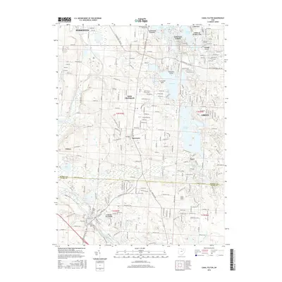
2016 Map of Canal Fulton
USGS Topo · Published 2016About this map
Canal Fulton sits at the southern reach of this landscape, where the Tuscarawas River and Canal Feeder meet. The map reveals a transition from the established settlements of Barberton and New Franklin to a water-dominated geography defined by the Portage Lakes and the expansive Nimisila Reservoir. Local history is anchored in numerous community burial grounds, including the Union Cem and Saint Phillips Cem. The presence of the W & Le RR tracks and the Canal Fulton Airport illustrates the varied transportation layers that have shaped the region. Smaller residential pockets like Turkeyfoot Beach, Cottage Grove, and the Infant of Prague Villa dot the shorelines, reflecting the area's development around its prominent glacial lakes and man-made reservoirs.
Find a feature on this map
169 named features on this map. Tap any name to fly to it.
Don’t see what you’re looking for? This feature index may not catch every label — zoom into the map to look around manually.
Map Details
Editions of this 2016 Canal Fulton Map
This is the sole edition of this map. No revisions or reprints were ever made.
Other maps of this area

1901 · Massillon
USGS Topo · 1:62,500

1901 · Canton
USGS Topo · 1:62,500

1903 · Massillon
USGS Topo · 1:62,500

1903 · Canton
USGS Topo · 1:62,500

1903 · Akron
USGS Topo · 1:62,500

1905 · Akron
USGS Topo · 1:62,500

1906 · Kent
USGS Topo · 1:62,500

1950 · Cleveland
USGS Topo · 1:250,000

1951 · Canton
USGS Topo · 1:250,000

1953 · Canton
USGS Topo · 1:250,000