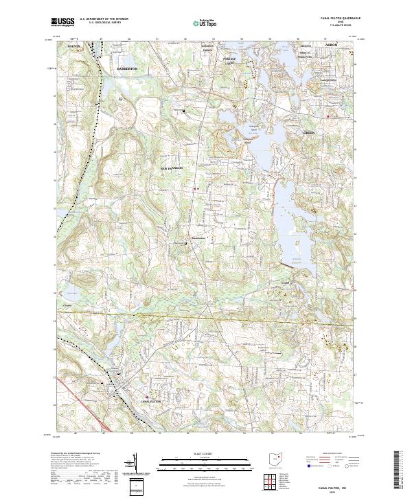
2023 Map of Canal Fulton
USGS Topo · Published 2023About this map
Canal Fulton sits at the southern end of a landscape defined by the historic passage of the Ohio and Erie Canal and the Tuscarawas River. This contemporary survey shows the complex relationship between natural water systems and man-made reservoirs, most notably the Nimisila Reservoir and the interconnected Portage Lakes including Rex Lake and Grape Lake. The area's long-standing community centers are anchored by historic sites such as the Saints Philip and James Church Cem and the Manchester Cem.
Find a feature on this map
153 named features on this map. Tap any name to fly to it.
Don’t see what you’re looking for? This feature index may not catch every label — zoom into the map to look around manually.
Map Details
Editions of this 2023 Canal Fulton Map
This is the sole edition of this map. No revisions or reprints were ever made.
Other maps of this area

1901 · Massillon
USGS Topo · 1:62,500

1901 · Canton
USGS Topo · 1:62,500

1903 · Massillon
USGS Topo · 1:62,500

1903 · Canton
USGS Topo · 1:62,500

1903 · Akron
USGS Topo · 1:62,500

1905 · Akron
USGS Topo · 1:62,500

1906 · Kent
USGS Topo · 1:62,500

1950 · Cleveland
USGS Topo · 1:250,000

1951 · Canton
USGS Topo · 1:250,000

1953 · Canton
USGS Topo · 1:250,000