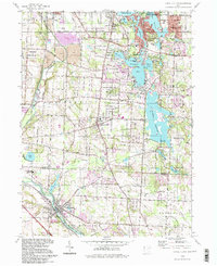
1994 Map of Canal Fulton
USGS Topo · Published 1997About this map
Canal Fulton sits at the southern edge of this landscape, where the historic Ohio Canal and the Tuscarawas River run parallel, marking the corridor of 19th-century trade and transport. By the mid-1990s, the region reflected a complex mix of industrial history and leisure, with the northern reaches dominated by the Portage Lakes State Park system, including Turkeyfoot Lake and Rex Lake. The heavy industry of Barberton and Norton in the northwest is evident through extensive Tailings and sewage infrastructure, contrasting with the recreational sprawl around the Nimisila Reservoir. Local history is preserved in landmarks like the Manchester Cem and the Township Sch in Manchester. The map also captures the path of the Penn Central railroad, illustrating how these legacy transport routes continued to define the boundaries of Summit and Stark counties.
Find a feature on this map
70 named features on this map. Tap any name to fly to it.
Don’t see what you’re looking for? This feature index may not catch every label — zoom into the map to look around manually.
Map Details
Editions of this 1994 Canal Fulton Map
This is the sole edition of this map. No revisions or reprints were ever made.
Other maps of this area

1901 · Massillon
USGS Topo · 1:62,500

1901 · Canton
USGS Topo · 1:62,500

1903 · Massillon
USGS Topo · 1:62,500

1903 · Canton
USGS Topo · 1:62,500

1903 · Akron
USGS Topo · 1:62,500

1905 · Akron
USGS Topo · 1:62,500

1906 · Kent
USGS Topo · 1:62,500

1950 · Cleveland
USGS Topo · 1:250,000

1951 · Canton
USGS Topo · 1:250,000

1953 · Canton
USGS Topo · 1:250,000