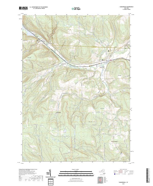
2023 Map of Canaseraga
USGS Topo · Published 2023About this map
Canaseraga Creek flows northwest through a deeply carved valley, anchoring a series of small settlements along the NYS 70 corridor. This modern survey illustrates the persistent layout of villages like Canaseraga and Swain, where the local cemetery records—including Saint Marys Cem and Canaseraga Cem—trace generations of families in the southern Tier. The landscape transitions from the creek valley into high ridges, including Tildon Hill and Miller Hill, where the North Country National Scenic Trl traverses the higher elevations. Rural routes such as Turkey Path and Big Hollow Rd wind through the hills, connecting isolated homesteads to the village centers. To the south, North Almond sits near the headwaters of the Canisteo River, marking the divide between the local drainage systems. The map provides a clear view of the rural infrastructure that remains central to this corner of Allegany Co.
Find a feature on this map
79 named features on this map. Tap any name to fly to it.
Don’t see what you’re looking for? This feature index may not catch every label — zoom into the map to look around manually.
Map Details
Editions of this 2023 Canaseraga Map
This is the sole edition of this map. No revisions or reprints were ever made.
Other maps of this area

1902 · Wayland
USGS Topo · 1:62,500

1904 · Wayland
USGS Topo · 1:62,500

1905 · Nunda
USGS Topo · 1:62,500

1915 · Hornell
USGS Topo · 1:62,500

1916 · Canaseraga
USGS Topo · 1:62,500

1918 · Hornell
USGS Topo · 1:62,500

1940 · Canaseraga
USGS Topo · 1:62,500

1942 · Dansville
USGS Topo · 1:31,680

1943 · Nunda
USGS Topo · 1:24,000

1943 · Ossian
USGS Topo · 1:24,000