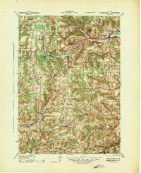
1940 Map of Canaseraga
USGS Topo · Published 1942About this map
Canaseraga and the surrounding Allegany County uplands are captured here in a 1940 revision of earlier surveys, revealing a landscape defined by its rural school districts and narrow-gauge rail history. The northern portion of the map follows the corridor of the Erie and P S & N railroads through the Canaseraga Creek valley, where stops like Garwoods Sta and Whitney Crossings served the agricultural needs of the day. A high concentration of numbered schoolhouses, such as School No 12 and School No 17, along with named institutions like the New Michigan School, indicates a decentralized rural community structure before the mid-century consolidation of school districts. Notable local landmarks include the County House in the township of Allen and the village of Alfred, showing the early 20th-century development of these southern tier settlements near Phillips Creek and the Canisteo River.
Find a feature on this map
58 named features on this map. Tap any name to fly to it.
Don’t see what you’re looking for? This feature index may not catch every label — zoom into the map to look around manually.
Map Details
Editions of this 1940 Canaseraga Map
2 editions found

Other maps of this area

1902 · Wayland
USGS Topo · 1:62,500

1904 · Wayland
USGS Topo · 1:62,500

1905 · Portage
USGS Topo · 1:62,500

1905 · Nunda
USGS Topo · 1:62,500

1906 · Angelica
USGS Topo · 1:62,500

1915 · Hornell
USGS Topo · 1:62,500

1916 · Canaseraga
USGS Topo · 1:62,500

1918 · Hornell
USGS Topo · 1:62,500

1925 · Belmont
USGS Topo · 1:62,500

1926 · Wellsville
USGS Topo · 1:62,500