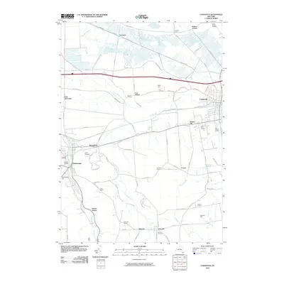
2010 Map of Canastota
USGS Topo · Published 2010About this map
Chittenango and Canastota anchor the eastern and western edges of this Madison County landscape in the early 21st century. The map reveals a dense network of rural roads connecting historic crossroads such as Oniontown, Quality Hill, and Perryville. The terrain is defined by distinct elevations like Brinkerhoff Hill and Lillies Pinnacle, while the lowlands are carved by a complex drainage system including Cowaselon Creek, Canaseraga Creek, and numerous agricultural ditches. Genealogists and local historians will find significant detail in the many documented burial sites, from the large Oakwood Cemetery to smaller family-named locations like the Allis Cemetery and Walker Corners Cemetery. The area's small-scale infrastructure is marked by local landmarks like Luther Airport and the Canastota Reservoir, reflecting a community character shaped by both its agricultural roots and its position along the Sullivan town corridor.
Find a feature on this map
85 named features on this map. Tap any name to fly to it.
Don’t see what you’re looking for? This feature index may not catch every label — zoom into the map to look around manually.
Map Details
Editions of this 2010 Canastota Map
This is the sole edition of this map. No revisions or reprints were ever made.
Other maps of this area

1895 · Chittenango
USGS Topo · 1:62,500

1895 · Oneida
USGS Topo · 1:62,500

1897 · Cazenovia
USGS Topo · 1:62,500

1898 · Oneida
USGS Topo · 1:62,500

1898 · Chittenango
USGS Topo · 1:62,500

1899 · Cazenovia
USGS Topo · 1:62,500

1902 · Chittenango
USGS Topo · 1:62,500

1902 · Morrisville
USGS Topo · 1:62,500

1902 · Oneida
USGS Topo · 1:62,500

1939 · Oneida
USGS Topo · 1:62,500