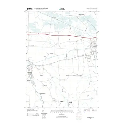
2013 Map of Canastota
USGS Topo · Published 2013About this map
Canastota and Chittenango anchor this central New York landscape, where the agricultural flats of the north meet the rising terrain of the south. The drainage patterns of Canaseraga Cr and Cowaselon Cr reveal the importance of the local watershed, leading toward the marshy lowlands near Oniontown. This 2013 edition details a dense network of country roads connecting smaller settlements like East Boston, Quality Hill, and Cottons. Genealogists will find a wealth of local history in the numerous burial grounds, including Oakwood Cem and the Lenox Rural Cem near Quality Hill. Significant elevation changes are marked by landmarks such as Lillies Pinnacle and Brinkerhoff Hill, while the southern reaches feature the Perryville Falls near the hamlet of Perryville. Small regional aviation hubs like Luther Airport and Lakeview Airport further illustrate the modern utilization of this storied rural corridor.
Find a feature on this map
141 named features on this map. Tap any name to fly to it.
Don’t see what you’re looking for? This feature index may not catch every label — zoom into the map to look around manually.
Map Details
Editions of this 2013 Canastota Map
This is the sole edition of this map. No revisions or reprints were ever made.
Other maps of this area

1895 · Chittenango
USGS Topo · 1:62,500

1895 · Oneida
USGS Topo · 1:62,500

1897 · Cazenovia
USGS Topo · 1:62,500

1898 · Oneida
USGS Topo · 1:62,500

1898 · Chittenango
USGS Topo · 1:62,500

1899 · Cazenovia
USGS Topo · 1:62,500

1902 · Chittenango
USGS Topo · 1:62,500

1902 · Morrisville
USGS Topo · 1:62,500

1902 · Oneida
USGS Topo · 1:62,500

1939 · Oneida
USGS Topo · 1:62,500