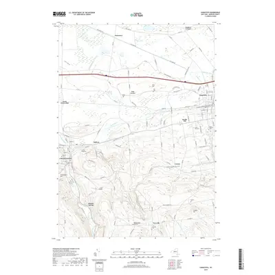
2019 Map of Canastota
USGS Topo · Published 2019About this map
Chittenango and Canastota anchor this modern survey of Madison County, showing the evolution of the landscape between the historic Erie Canal corridor and the high ground of the Allegheny Plateau. The transition from the low-lying northern marshes around Oniontown and Cowaselon Creek to the significant elevations of Allis Hill and Cranson Hill is clearly visible. The drainage patterns of Chittenango Creek and Canaseraga Creek continue to define the area's geography, while the N Country National Scenic Trail traverses the southern ridges. Genealogists will find many significant burial sites, including the Lenox Rural Cemetery, Mount Pleasant Cemetery, and the Harrington Cemetery, providing a detailed record of the families who settled this region of Central New York. Landmarks like Sulphur Springs and Luther Airport indicate the varied recreational and logistical uses of the land in the early 21st century.
Find a feature on this map
113 named features on this map. Tap any name to fly to it.
Don’t see what you’re looking for? This feature index may not catch every label — zoom into the map to look around manually.
Map Details
Editions of this 2019 Canastota Map
This is the sole edition of this map. No revisions or reprints were ever made.
Other maps of this area

1895 · Chittenango
USGS Topo · 1:62,500

1895 · Oneida
USGS Topo · 1:62,500

1897 · Cazenovia
USGS Topo · 1:62,500

1898 · Oneida
USGS Topo · 1:62,500

1898 · Chittenango
USGS Topo · 1:62,500

1899 · Cazenovia
USGS Topo · 1:62,500

1902 · Chittenango
USGS Topo · 1:62,500

1902 · Morrisville
USGS Topo · 1:62,500

1902 · Oneida
USGS Topo · 1:62,500

1939 · Oneida
USGS Topo · 1:62,500