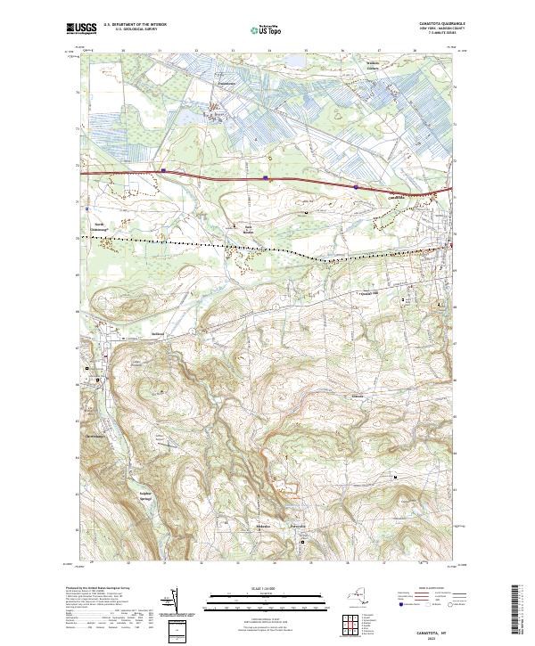
2023 Map of Canastota
USGS Topo · Published 2023About this map
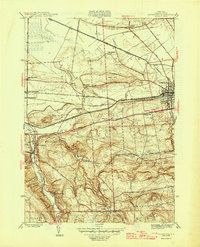
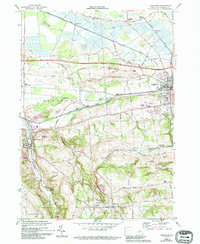
Canastota and Chittenango anchor this transition between the flat, drained marshlands of the north and the rising elevations of the southern hills. The landscape is defined by the legacy of early drainage and agriculture, clearly visible in the straight channels of Ditch Bank Rd W and the meandering path of Canaseraga Creek. Small agricultural hamlets like Oniontown and Quality Hill are dispersed among numerous family-named landmarks and rural burial grounds, including the Lenox Rural Cem and Mount Pleasant Cem. The terrain rises sharply toward Cranson Hill and Allis Hill, where the settlement pattern shifts from the gridded village streets of the lowlands to the more scattered rural clusters of Perryville and Blakeslee. The presence of Sulphur Springs and Luther Airport reflects the diverse recreational and transport uses of the land in this corner of Madison County.
Find a feature on this map
127 named features on this map. Tap any name to fly to it.
Don’t see what you’re looking for? This feature index may not catch every label — zoom into the map to look around manually.
Map Details
Editions of this 2023 Canastota Map
This is the sole edition of this map. No revisions or reprints were ever made.
Historical Maps of Quality Hill Through Time
3 maps found