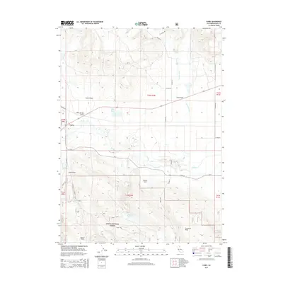
2015 Map of Canby
USGS Topo · Published 2015About this map
The Pit River meanders through this high-desert landscape of Northern California, winding its way through Warm Springs Valley and past the small community of Canby. This 2015 U.S. Geological Survey representation highlights a transition from the riparian corridors and open swales of the north to the upland timber and ridgelines of the Modoc National Forest in the south. The area is characterized by significant water resources, including the geothermal activity at Kelley Hot Spring and several man-made impoundments like Ballard Reservoir and Wilson Reservoir.
Find a feature on this map
40 named features on this map. Tap any name to fly to it.
Don’t see what you’re looking for? This feature index may not catch every label — zoom into the map to look around manually.
Map Details
Editions of this 2015 Canby Map
This is the sole edition of this map. No revisions or reprints were ever made.
Other maps of this area

1886 · Alturas
USGS Topo · 1:250,000

1892 · Alturas
USGS Topo · 1:250,000

1954 · Alturas
USGS Topo · 1:250,000

1958 · Alturas
USGS Topo · 1:250,000

1961 · Canby
USGS Topo · 1:62,500

1961 · Alturas
USGS Topo · 1:62,500

1962 · Alturas
USGS Topo · 1:250,000

1962 · Big Sage Reservoir
USGS Topo · 1:62,500

1962 · Jacks Butte
USGS Topo · 1:62,500

1965 · Alturas
USGS Topo · 1:250,000