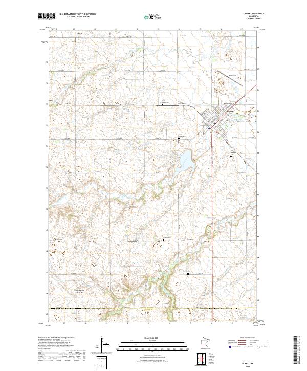
2022 Map of Canby
USGS Topo · Published 2022About this map
Canby and the surrounding prairie of Yellow Medicine and Lincoln counties are defined by the winding course of the Lac qui Parle River and its tributaries. The landscape sits along the Coteau des Prairies, an upland plateau that shapes the local hydrology, sending Canby Cr and Lazarus Cr through the agricultural grid. To the northwest, the small settlement of Burr sits along the roadway, while the larger center of Canby is clearly mapped with its street grid and Myers Field landing strip.
Find a feature on this map
44 named features on this map. Tap any name to fly to it.
Don’t see what you’re looking for? This feature index may not catch every label — zoom into the map to look around manually.
Map Details
Editions of this 2022 Canby Map
This is the sole edition of this map. No revisions or reprints were ever made.
Other maps of this area

1953 · Watertown
USGS Topo · 1:250,000

1958 · Watertown
USGS Topo · 1:250,000

1967 · Canby
USGS Topo · 1:24,000

1967 · Dawson SW
USGS Topo · 1:24,000

1967 · Gary
USGS Topo · 1:24,000

1967 · Canby NW
USGS Topo · 1:24,000

1967 · Porter
USGS Topo · 1:24,000
1967 · Porter SW
USGS Topo · 1:24,000

1967 · Gary SE
USGS Topo · 1:24,000

1967 · Canby SE
USGS Topo · 1:24,000