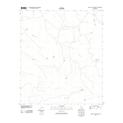
2010 Map of Candilla Canyon West
USGS Topo · Published 2010About this map
San Francisco lies in the southeastern reach of this West Texas landscape, where ephemeral watercourses like San Francisco Creek and Maxon Creek carve through the arid terrain. The map captures a ranching environment defined by wide-spaced homesteads, including Garcia Ranch to the northwest and Stewart Ranch near the center. These outposts are connected by a sparse network of dirt tracks such as Five Mile Hill Rd and Case Rd. The geography is dominated by numerous canyons, with Brindle Canyon and Candilla Canyon cutting deep into the mesas. At Indian Wells, the hydrology of the region is evident where seasonal drainages like Horse Creek converge. This survey provides a record of land use in Brewster County, documenting the essential relationship between reliable water sources and the isolated ranching life that has long characterized this part of the Trans-Pecos.
Find a feature on this map
19 named features on this map. Tap any name to fly to it.
Don’t see what you’re looking for? This feature index may not catch every label — zoom into the map to look around manually.
Map Details
Editions of this 2010 Candilla Canyon West Map
This is the sole edition of this map. No revisions or reprints were ever made.
Other maps of this area

1918 · Bullis Gap
USGS Topo · 1:62,500

1918 · Indian Wells
USGS Topo · 1:62,500

1920 · Longfellow
USGS Topo · 1:125,000

1928 · Sanderson
USGS Topo · 1:125,000

1954 · Fort Stockton
USGS Topo · 1:250,000

1958 · Fort Stockton
USGS Topo · 1:250,000

1959 · Emory Peak
USGS Topo · 1:250,000

1965 · Emory Peak
USGS Topo · 1:250,000

1968 · Big Brindle Canyon
USGS Topo · 1:24,000

1969 · Sanderson SE
USGS Topo · 1:24,000