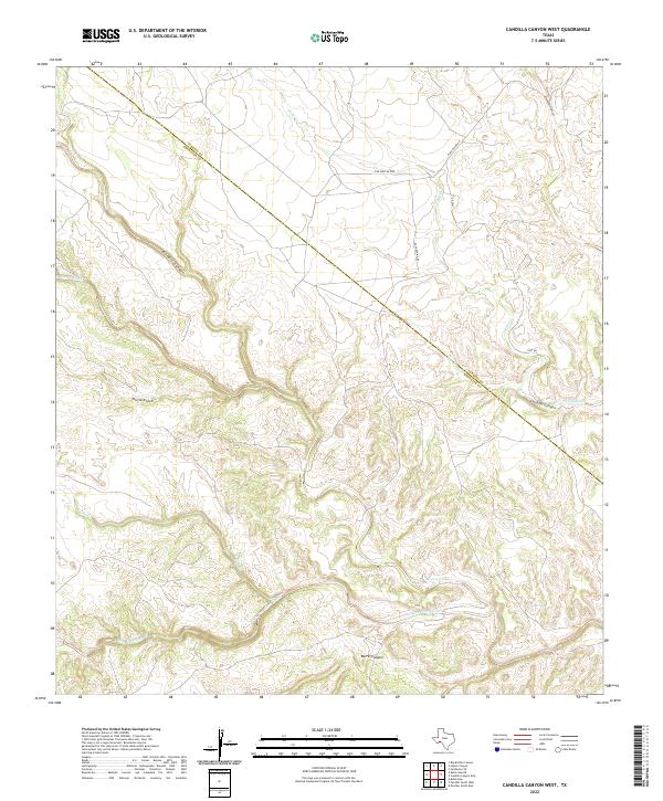
2022 Map of Candilla Canyon West
USGS Topo · Published 2022About this map
San Francisco Creek and its many tributaries, such as San Francisco Cr and Maxon Creek, define this West Texas landscape where the high desert meets complex canyon topography. The terrain is marked by deep drainage systems including Candilla Canyon, Brindle Canyon, and the appropriately named Washboard Canyon. A significant geopolitical line crosses the sheet, marking the Terrell Co Brewster Co boundary, illustrating how historical administrative divisions often bisect these remote desert reaches. Human activity is sparse, recorded through a few isolated tracks like Five Mile Hill Rd and Case Rd. Near the eastern edge, Coe Springs provides a rare and vital water source in this arid environment, while the network of dry washes like Horse Creek and Cow Cr suggests the path of seasonal runoff that continues to carve the local geology.
Find a feature on this map
17 named features on this map. Tap any name to fly to it.
Don’t see what you’re looking for? This feature index may not catch every label — zoom into the map to look around manually.
Map Details
Editions of this 2022 Candilla Canyon West Map
This is the sole edition of this map. No revisions or reprints were ever made.
Other maps of this area

1918 · Bullis Gap
USGS Topo · 1:62,500

1918 · Indian Wells
USGS Topo · 1:62,500

1920 · Longfellow
USGS Topo · 1:125,000

1928 · Sanderson
USGS Topo · 1:125,000

1954 · Fort Stockton
USGS Topo · 1:250,000

1958 · Fort Stockton
USGS Topo · 1:250,000

1959 · Emory Peak
USGS Topo · 1:250,000

1965 · Emory Peak
USGS Topo · 1:250,000

1968 · Big Brindle Canyon
USGS Topo · 1:24,000

1969 · Sanderson SE
USGS Topo · 1:24,000