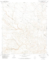
1983 Map of Candilla Canyon West
USGS Topo · Published 1984About this map
Rock Ravine Ranch and Deer Canyon Ranch represent the primary human habitations in this arid portion of Brewster County during the early 1980s. The landscape is defined by an intricate network of drainage systems, including the prominent San Francisco Creek and Candilla Creek, which have carved deep canyons through the high desert terrain. An Indefinite Boundary separates Brewster from neighboring Terrell County, cutting across the drainages of Brindle Canyon and Cedar Creek. The presence of several isolated water sources, such as Indian Wells and various scattered tanks, underscores the vital importance of water management for the livestock operations that defined the local economy of this Trans-Pecos region.
Find a feature on this map
18 named features on this map. Tap any name to fly to it.
Don’t see what you’re looking for? This feature index may not catch every label — zoom into the map to look around manually.
Map Details
Editions of this 1983 Candilla Canyon West Map
This is the sole edition of this map. No revisions or reprints were ever made.
Other maps of this area

1918 · Bullis Gap
USGS Topo · 1:62,500

1918 · Indian Wells
USGS Topo · 1:62,500

1920 · Longfellow
USGS Topo · 1:125,000

1928 · Sanderson
USGS Topo · 1:125,000

1954 · Fort Stockton
USGS Topo · 1:250,000

1958 · Fort Stockton
USGS Topo · 1:250,000

1959 · Emory Peak
USGS Topo · 1:250,000

1965 · Emory Peak
USGS Topo · 1:250,000

1968 · Big Brindle Canyon
USGS Topo · 1:24,000

1969 · Sanderson SE
USGS Topo · 1:24,000