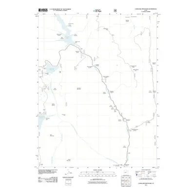
2011 Map of Candland Mountain
USGS Topo · Published 2011About this map
Electric Lake and its corresponding Electric Lake Dam dominate the northern drainage of this high-altitude landscape in the Wasatch Plateau. The map documents an area defined by resource extraction and water management, where numerous mines such as the Fireside Mine and Huntington Mine are situated among the deep drainages of Cox Canyon and Ragman Canyon. The infrastructure of the early 21st century is visible through the network of forest roads and water reservoirs including the Cleveland Reservoir and Miller Flat Reservoir. These landmarks, along with Seeley Ranch, reflect a long-standing history of seasonal grazing and industrial use. Topographically, the map centers on the massive bulk of Candland Mountain, surrounded by smaller peaks like Monument Peak and Bald Mountain, which dictate the flow of Huntington Creek and its many tributaries.
Find a feature on this map
49 named features on this map. Tap any name to fly to it.
Don’t see what you’re looking for? This feature index may not catch every label — zoom into the map to look around manually.
Map Details
Editions of this 2011 Candland Mountain Map
This is the sole edition of this map. No revisions or reprints were ever made.
Other maps of this area

1885 · Manti
USGS Topo · 1:250,000

1895 · Manti
USGS Topo · 1:250,000

1923 · Scofield
USGS Topo · 1:62,500

1923 · Hiawatha
USGS Topo · 1:62,500

1925 · Scofield
USGS Topo · 1:62,500

1925 · Hiawatha
USGS Topo · 1:62,500

1956 · Price
USGS Topo · 1:250,000

1960 · Price
USGS Topo · 1:250,000

1962 · Price
USGS Topo · 1:250,000

1965 · Huntington Reservoir
USGS Topo · 1:24,000