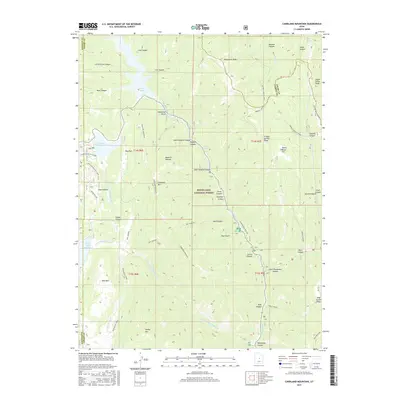
2017 Map of Candland Mountain
USGS Topo · Published 2017About this map
Candland Mountain rises as a central landmark within the Wasatch Plateau, where the borders of Sanpete, Emery, and Carbon counties converge. This high-altitude landscape is defined by its water management and infrastructure, anchored by the Electric Lake reservoir to the north and Miller Flat Reservoir to the southwest. The distribution of features like the Huntington Pipeline and the Sawmill Canyon Trail reflects a wilderness managed for both resource extraction and recreation within the Manti-La Sal National Forest. Steep drainage systems including North Hughes Canyon, Flood Canyon, and Pole Canyon carve through the plateau, illustrating the complex hydrology that feeds Huntington Creek. To the south, the peaks of Bald Mtn and Seeley Mtn overlook the Scad Valley Trail, marking a terrain defined by high ridges and deep canyons.
Find a feature on this map
55 named features on this map. Tap any name to fly to it.
Don’t see what you’re looking for? This feature index may not catch every label — zoom into the map to look around manually.
Map Details
Editions of this 2017 Candland Mountain Map
This is the sole edition of this map. No revisions or reprints were ever made.
Other maps of this area

1885 · Manti
USGS Topo · 1:250,000

1895 · Manti
USGS Topo · 1:250,000

1923 · Scofield
USGS Topo · 1:62,500

1923 · Hiawatha
USGS Topo · 1:62,500

1925 · Scofield
USGS Topo · 1:62,500

1925 · Hiawatha
USGS Topo · 1:62,500

1956 · Price
USGS Topo · 1:250,000

1960 · Price
USGS Topo · 1:250,000

1962 · Price
USGS Topo · 1:250,000

1965 · Huntington Reservoir
USGS Topo · 1:24,000