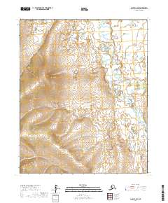
2017 Map of Candle C-6 SW
USGS Topo · Published 2017About this map
The Kiwalik River and its network of tributaries define the hydrology of this Northwest Arctic landscape as it was documented in 2017. The terrain is structured by a series of drainages, including the aptly named Gold Run and Coal Cr, which suggest the historic mineral interests that often drew surveyors to this portion of Alaska. The winding paths of Boulder Cr, Canoe Cr, and Quartz Cr reveal a complex watershed that flows through the township boundaries of t2n r15w and t2n r16w. This map captures the region's physical character, showing the interplay between elevation and the seasonal waterways that carve through the tundra. The absence of modern infrastructure underscores the wild state of these river corridors, providing a baseline for researchers studying Arctic geomorphology or the placement of early mining claims.
Find a feature on this map
12 named features on this map. Tap any name to fly to it.
Don’t see what you’re looking for? This feature index may not catch every label — zoom into the map to look around manually.
Map Details
Editions of this 2017 Candle C-6 SW Map
This is the sole edition of this map. No revisions or reprints were ever made.
Other maps of this area

1950 · Bendeleben C-1
USGS Topo · 1:63,360

1950 · Bendeleben B-1
USGS Topo · 1:63,360

1950 · Bendeleben
USGS Topo · 1:250,000

1950 · Candle B-6
USGS Topo · 1:63,360

1950 · Candle C-6
USGS Topo · 1:63,360

1951 · Candle
USGS Topo · 1:250,000

1951 · Bendeleben
USGS Topo · 1:250,000

1955 · Candle
USGS Topo · 1:250,000

1964 · Bendeleben
USGS Topo · 1:250,000

1964 · Candle
USGS Topo · 1:250,000