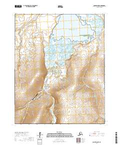
2017 Map of Candle D-6 NW
USGS Topo · Published 2017About this map
Candle stands as the primary hub of human activity on this northern Seward Peninsula landscape, positioned where the Kiwalik River winds through the tundra toward the coast. This 2017 survey details the intersection of regional transport and conservation, showing the proximity of the Candle 2 Airport to the town and the vast reaches of the Alaska Maritime National Wildlife Refuge. The hydrology of the region is a central focus, as various tributaries like Minnehaha Creek, Mud Channel Creek, and Wabash Creek feed into the expansive Kiwalik Lagoon and ultimately the Kotzebue Sound. The map illustrates the characteristic arctic terrain of the Northwest Arctic Borough, where isolated settlements rely on river systems and small airfields for connectivity. Local waterways such as Jump Cr and Candle Cr define the drainages around the townsite, reflecting the area's history of remote mining and seasonal habitation.
Find a feature on this map
18 named features on this map. Tap any name to fly to it.
Don’t see what you’re looking for? This feature index may not catch every label — zoom into the map to look around manually.
Map Details
Editions of this 2017 Candle D-6 NW Map
This is the sole edition of this map. No revisions or reprints were ever made.
Other maps of this area

1950 · Kotzebue A-1
USGS Topo · 1:63,360

1950 · Bendeleben
USGS Topo · 1:250,000

1950 · Bendeleben D-1
USGS Topo · 1:63,360

1951 · Candle
USGS Topo · 1:250,000

1951 · Selawik
USGS Topo · 1:250,000

1951 · Bendeleben
USGS Topo · 1:250,000

1951 · Kotzebue
USGS Topo · 1:250,000

1951 · Candle D-6
USGS Topo · 1:63,360

1951 · Selawik A-6
USGS Topo · 1:63,360

1955 · Candle
USGS Topo · 1:250,000