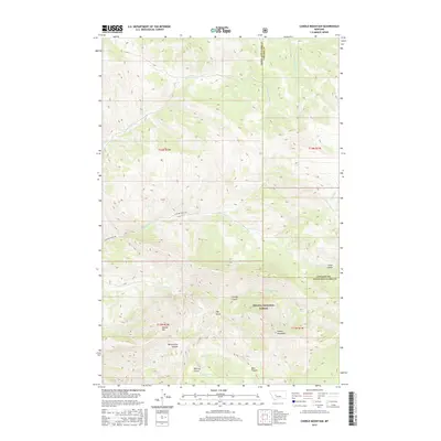
2017 Map of Candle Mountain
USGS Topo · Published 2017About this map
Helena National Forest land dominates this high-altitude terrain along the boundary of Lewis and Clark and Cascade counties. The landscape is defined by a series of prominent peaks and drainages, most notably Candle Mountain and the neighboring Willow Mtn. These summits overlook a complex system of gulches and canyons, including Meriwether Canyon and Big Log Gulch, which provide natural conduits for water sources like Kennedy Spring.
Find a feature on this map
23 named features on this map. Tap any name to fly to it.
Don’t see what you’re looking for? This feature index may not catch every label — zoom into the map to look around manually.
Map Details
Editions of this 2017 Candle Mountain Map
This is the sole edition of this map. No revisions or reprints were ever made.
Other maps of this area

1886 · Great Falls
USGS Topo · 1:250,000

1886 · Fort Logan
USGS Topo · 1:250,000

1948 · White Sulphur Springs
USGS Topo · 1:250,000

1954 · Great Falls
USGS Topo · 1:250,000

1957 · Great Falls
USGS Topo · 1:250,000

1958 · White Sulphur Springs
USGS Topo · 1:250,000

1961 · White Sulphur Springs
USGS Topo · 1:250,000

1961 · Craig
USGS Topo · 1:24,000

1961 · Hound Creek Reservoir
USGS Topo · 1:24,000
1961 · The Sawteeth
USGS Topo · 1:24,000