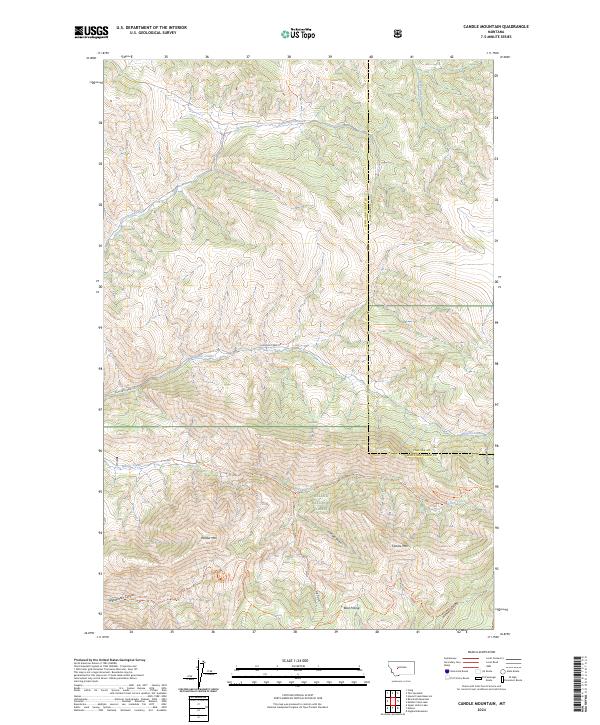
2024 Map of Candle Mountain
USGS Topo · Published 2024About this map
Gates of the Mountains Wilderness dominates the southern half of this landscape, where the high ridges of the Big Belt Mountains define the geography of the Helena National Forest. The terrain is marked by dramatic elevation changes between peaks like Candle Mtn and Willow Mtn and the deep incisions of Meriwether Canyon and Hunters Gulch. A network of backcountry routes, including the Refrigerator Canyon Trl and Big Log Gulch Trl, suggests a region primarily used for conservation and recreation rather than permanent settlement. The northern reaches transition into more accessible lands bisected by the Elkhorn Creek Rd, following the drainage of Elkhorn Creek across the Lewis and Clark and Cascade county line. Local landmarks like Bear Prairie and Kennedy Spring provide specific points of reference for those tracing historical trails or surveying the modern wildlands of central Montana.
Find a feature on this map
28 named features on this map. Tap any name to fly to it.
Don’t see what you’re looking for? This feature index may not catch every label — zoom into the map to look around manually.
Map Details
Editions of this 2024 Candle Mountain Map
This is the sole edition of this map. No revisions or reprints were ever made.
Other maps of this area

1886 · Great Falls
USGS Topo · 1:250,000

1886 · Fort Logan
USGS Topo · 1:250,000

1948 · White Sulphur Springs
USGS Topo · 1:250,000

1954 · Great Falls
USGS Topo · 1:250,000

1957 · Great Falls
USGS Topo · 1:250,000

1958 · White Sulphur Springs
USGS Topo · 1:250,000

1961 · White Sulphur Springs
USGS Topo · 1:250,000

1961 · Craig
USGS Topo · 1:24,000

1961 · Hound Creek Reservoir
USGS Topo · 1:24,000
1961 · The Sawteeth
USGS Topo · 1:24,000