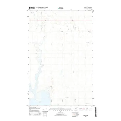
2014 Map of Cando NE
USGS Topo · Published 2014About this map
Mauvais Coulee meanders southward through this Towner County landscape, feeding into the northern reaches of Lake Alice and Chain Lake. The terrain is characterized by these expansive wetland systems and drainage channels, including the prominent Big Coulee in the northwest. This 2014 survey documents a sparsely populated agricultural region defined by a rigid grid of rural routes such as 73rd Ave NE and 70th St NE, which facilitate movement between scattered farmsteads. A notable aviation landmark, the Anderson Private Airport, is situated in the southeastern portion of the quadrangle near 67th St NE. The presence of ND-17 provides the primary east-west corridor through this prairie pothole region, where the intersection of water and roadway dictates the local geography.
Find a feature on this map
20 named features on this map. Tap any name to fly to it.
Don’t see what you’re looking for? This feature index may not catch every label — zoom into the map to look around manually.
Map Details
Editions of this 2014 Cando NE Map
This is the sole edition of this map. No revisions or reprints were ever made.
Other maps of this area

1953 · Devils Lake
USGS Topo · 1:250,000

1956 · Devils Lake
USGS Topo · 1:250,000

1957 · Cando SE
USGS Topo · 1:24,000

1957 · Cando
USGS Topo · 1:24,000

1957 · Cando NE
USGS Topo · 1:24,000

1957 · Churchs Ferry
USGS Topo · 1:24,000

1957 · Webster
USGS Topo · 1:24,000

1962 · Egeland SE
USGS Topo · 1:24,000

1962 · Egeland SW
USGS Topo · 1:24,000

1962 · Starkweather
USGS Topo · 1:24,000