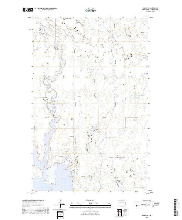
2024 Map of Cando NE
USGS Topo · Published 2024About this map
Lake Alice National Wildlife Refuge dominates the southern landscape of this Towner County quadrangle, preserving a vital wetland ecosystem centered around Lake Alice. The terrain is defined by the winding paths of Mauvais Coulee and Big Coulee, which cut through the undulating prairie. This area reflects the typical North Dakota section-line road grid, with routes like Egeland Rd and 73rd St NE providing access to the vast agricultural tracts. A notable modern landmark is the Anderson Private Airport, situated just east of the wildlife refuge boundaries. The map illustrates the characteristic glacial topography of the region, where numerous small seasonal wetlands and depressions pockmark the fields between the larger coulee drainage systems.
Find a feature on this map
24 named features on this map. Tap any name to fly to it.
Don’t see what you’re looking for? This feature index may not catch every label — zoom into the map to look around manually.
Map Details
Editions of this 2024 Cando NE Map
This is the sole edition of this map. No revisions or reprints were ever made.
Other maps of this area

1953 · Devils Lake
USGS Topo · 1:250,000

1956 · Devils Lake
USGS Topo · 1:250,000

1957 · Cando SE
USGS Topo · 1:24,000

1957 · Cando
USGS Topo · 1:24,000

1957 · Cando NE
USGS Topo · 1:24,000

1957 · Churchs Ferry
USGS Topo · 1:24,000

1957 · Webster
USGS Topo · 1:24,000

1962 · Egeland SE
USGS Topo · 1:24,000

1962 · Egeland SW
USGS Topo · 1:24,000

1962 · Starkweather
USGS Topo · 1:24,000