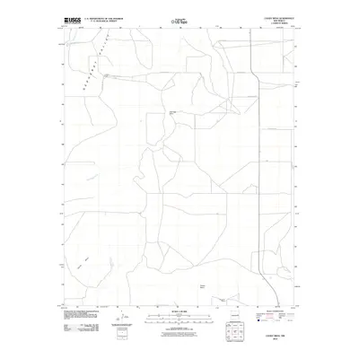
2010 Map of Candy Mesa
USGS Topo · Published 2010About this map
Gerhardt Valley dominates the northwestern reaches of this high-plains landscape, where the seasonal drainage of Truchas Creek cuts through the open terrain. This 2010 survey illustrates a sparse, ranch-oriented settlement pattern characteristic of eastern New Mexico, anchored by working properties like Knighten Ranch and M and M Ranch. The topography is defined by significant elevations such as Candy Mesa and Taiban Mesa, which rise above the valley floor to create distinct natural boundaries. A network of rural routes, including House Cap Rd and several numbered county roads like Quay Road 24, provides a framework for the vast cattle ranching operations that have long defined the local economy. The transition from the flat plains to features like Charlotte Point highlights the erosion-carved geology that shapes the region's ranching and land use history.
Find a feature on this map
17 named features on this map. Tap any name to fly to it.
Don’t see what you’re looking for? This feature index may not catch every label — zoom into the map to look around manually.
Map Details
Editions of this 2010 Candy Mesa Map
This is the sole edition of this map. No revisions or reprints were ever made.
Other maps of this area

1954 · Fort Sumner
USGS Topo · 1:250,000

1954 · Clovis
USGS Topo · 1:250,000

1958 · Fort Sumner
USGS Topo · 1:250,000

1958 · Clovis
USGS Topo · 1:250,000

1968 · Hassell
USGS Topo · 1:24,000

1968 · Twin Mesa NW
USGS Topo · 1:24,000

1968 · Fort Sumner East
USGS Topo · 1:24,000

1968 · Candy Mesa
USGS Topo · 1:24,000

1968 · Taiban
USGS Topo · 1:24,000

1968 · Twin Mesa
USGS Topo · 1:24,000