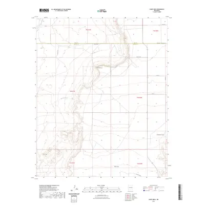
2023 Map of Candy Mesa
USGS Topo · Published 2023About this map
Candy Mesa and Taiban Mesa dominate this high-desert landscape on the boundary of Quay and De Baca counties. The terrain is defined by dramatic escarpments and canyon systems, most notably Cottonwood Canyon and the prominent overlook at Charlotte Point. Drainage for this arid region is channeled through seasonal watercourses such as Truchas Creek and Red Tank Creek.
Find a feature on this map
22 named features on this map. Tap any name to fly to it.
Don’t see what you’re looking for? This feature index may not catch every label — zoom into the map to look around manually.
Map Details
Editions of this 2023 Candy Mesa Map
This is the sole edition of this map. No revisions or reprints were ever made.
Other maps of this area

1954 · Fort Sumner
USGS Topo · 1:250,000

1954 · Clovis
USGS Topo · 1:250,000

1958 · Fort Sumner
USGS Topo · 1:250,000

1958 · Clovis
USGS Topo · 1:250,000

1968 · Hassell
USGS Topo · 1:24,000

1968 · Twin Mesa NW
USGS Topo · 1:24,000

1968 · Fort Sumner East
USGS Topo · 1:24,000

1968 · Candy Mesa
USGS Topo · 1:24,000

1968 · Taiban
USGS Topo · 1:24,000

1968 · Twin Mesa
USGS Topo · 1:24,000