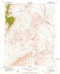
1952 Map of Cane Spring
USGS Topo · Published 1962About this map
The Nevada Test Site occupies the heart of this landscape, reflecting a pivotal era of mid-century desert activity. The geography is defined by broad basins like Yucca Flat and Jackass Flats, connected by strategic infrastructure such as the Mercury Highway. While the terrain is dominated by high ridges like Skull Mountain and Shoshone Mountain, the human history is found in scattered outposts. The Wahmonie (Site) and the Horn Silver Mine recall earlier mining interests that predated the region's federal transformation. Aviation and communication links are evident through the Yucca Landing Strip and a prominent Telephone Line. Seasonal water features like Cane Spring Wash and Neilson Wash illustrate the drainage patterns of this arid environment, leading toward the dry expanse of Yucca Lake.
Find a feature on this map
37 named features on this map. Tap any name to fly to it.
Don’t see what you’re looking for? This feature index may not catch every label — zoom into the map to look around manually.
Map Details
Editions of this 1952 Cane Spring Map
3 editions found
Other maps of this area

1907 · Las Vegas
USGS Topo · 1:250,000

1908 · Kawich
USGS Topo · 1:250,000

1908 · Furnace Creek
USGS Topo · 1:250,000

1908 · Las Vegas
USGS Topo · 1:250,000

1910 · Furnace Creek
USGS Topo · 1:250,000

1942 · Emigrant Valley
USGS Topo · 1:125,000

1942 · Indian Spring
USGS Topo · 1:125,000

1942 · Wheelbarrow Peak
USGS Topo · 1:125,000

1942 · Skull Mountain
USGS Topo · 1:125,000

1948 · Death Valley
USGS Topo · 1:250,000