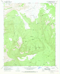
1967 Map of Cane Springs Mtn
USGS Topo · Published 1968About this map
Tonto National Forest and the Mazatzal Wilderness dominate this 1960s landscape, a region defined by high mesas and deep canyons. The southern reach is marked by the East Verde River, which flows beneath the prominent heights of Polles Mesa and Whiterock Mesa. The cartography reveals a reliance on isolated water sources for ranching or wildlife, evidenced by the numerous named tanks such as Black Jack Tank, Plowbeam Tank, and UA Tank.
Find a feature on this map
57 named features on this map. Tap any name to fly to it.
Don’t see what you’re looking for? This feature index may not catch every label — zoom into the map to look around manually.
Map Details
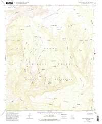
Editions of this 1967 Cane Springs Mtn Map
2 editions found
Other maps of this area

1887 · Verde
USGS Topo · 1:250,000

1892 · Verde
USGS Topo · 1:250,000

1929 · Turret Peak
USGS Topo · 1:125,000

1933 · Turret Peak
USGS Topo · 1:125,000

1934 · Pine
USGS Topo · 1:62,500

1936 · Payson
USGS Topo · 1:48,000

1940 · Pine
USGS Topo · 1:62,500

1942 · Payson
USGS Topo · 1:62,500

1952 · Pine
USGS Topo · 1:62,500

1954 · Holbrook
USGS Topo · 1:250,000