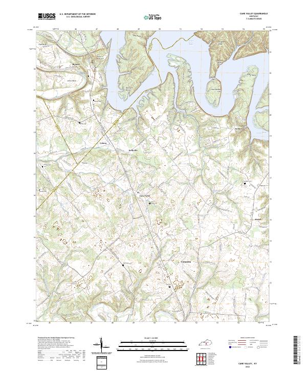
2022 Map of Cane Valley
USGS Topo · Published 2022About this map
Green River Lake dominates the northern reaches of this Adair County landscape, where its waters back into winding inlets like Fisher Bend and Buckners Bend. The terrain is characterized by high ridges and distinct geological breaks, including Buffalo Cliff and Little Bottom Cliff. This topographic study documents a rural Kentucky geography defined by its cemeteries and small settlements, such as Cane Valley and Coburg. For genealogists, the map is a significant resource, recording numerous family burial grounds including Faulkner Cem, Griffin Cem, and Hutchison Cem. Notable landmarks such as the Faulkner Sulphur Spring and the steep elevation of Green River Hill provide concrete points of interest in an area where the local economy and road network, including Cane Valley Mill Rd, have long been shaped by the winding paths of Russell Creek and the Green River.
Find a feature on this map
134 named features on this map. Tap any name to fly to it.
Don’t see what you’re looking for? This feature index may not catch every label — zoom into the map to look around manually.
Map Details
Editions of this 2022 Cane Valley Map
This is the sole edition of this map. No revisions or reprints were ever made.
Other maps of this area

1952 · Mannsville
USGS Topo · 1:24,000

1953 · Gradyville
USGS Topo · 1:24,000

1953 · Campbellsville
USGS Topo · 1:24,000

1953 · Montpelier
USGS Topo · 1:24,000

1953 · Gresham
USGS Topo · 1:24,000

1953 · Cane Valley
USGS Topo · 1:24,000

1954 · Knifley
USGS Topo · 1:24,000

1954 · Columbia
USGS Topo · 1:24,000

1954 · Greensburg
USGS Topo · 1:24,000

1957 · Winchester
USGS Topo · 1:250,000