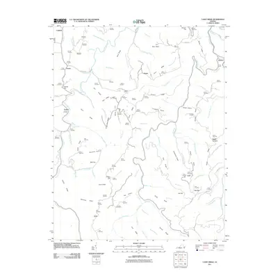
2011 Map of Caney Ridge
USGS Topo · Published 2011About this map
Cranes Nest River and its numerous tributaries carve a complex landscape of ridges and hollows in this 2011 survey of Dickenson County. The map provides an exceptionally high density of genealogical data, recording dozens of family-named burial sites including Lambert Cemetery, Stanley Cemetery, and Hibbitts Cemetery that dot the high ground above the watercourses. Small settlements like Darwin, Omaha, and McClure are linked by winding routes such as Caney Ridge Rd and Willie Yates Rd. Evidence of the region’s coal and rail heritage is visible through the engineering of the Bearpen Gap Tunnel and Caney Tunnel. From Mink Gap to the heights of Caney Ridge, the map documents a community deeply rooted in its vertical terrain, where nearly every hollow and ridge line bears a distinct name like Deadman Hollow or Frogpond Ridge.
Find a feature on this map
116 named features on this map. Tap any name to fly to it.
Don’t see what you’re looking for? This feature index may not catch every label — zoom into the map to look around manually.
Map Details
Editions of this 2011 Caney Ridge Map
This is the sole edition of this map. No revisions or reprints were ever made.
Other maps of this area

1886 · Grundy
USGS Topo · 1:125,000

1890 · Whitesburg
USGS Topo · 1:125,000

1890 · Grundy
USGS Topo · 1:125,000

1892 · Grundy
USGS Topo · 1:125,000

1892 · Whitesburg
USGS Topo · 1:125,000

1894 · Estillville
USGS Topo · 1:125,000

1897 · Bristol
USGS Topo · 1:125,000

1902 · Bristol
USGS Topo · 1:125,000

1912 · Pound
USGS Topo · 1:48,000

1913 · Clintwood
USGS Topo · 1:62,500