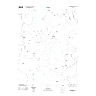
2013 Map of Caney Ridge
USGS Topo · Published 2013About this map
Cranes Nest River and Caney Cr carve through this section of the Appalachian Plateau, defining a landscape of narrow hollows and high, winding ridges. This 2013 survey shows a region deeply connected to its musical and cultural roots, evidenced by the Doctor Ralph Stanley Hwy and Carter Stanley Hwy passing through the eastern hills. Small settlements like Darwin, Omaha, and McClure are scattered along the creek beds, often clustered near gaps such as Hibbitts Gap and Mink Gap. The arrival of industry is marked by the presence of the Caney Tunnel and the rail line following the banks of McClure River. Numerous family-named landmarks, including Adkins Ridge, Buchanan Ridge, and Bill Ridge, speak to the deep genealogical history of the families who settled these coal-rich slopes.
Find a feature on this map
118 named features on this map. Tap any name to fly to it.
Don’t see what you’re looking for? This feature index may not catch every label — zoom into the map to look around manually.
Map Details
Editions of this 2013 Caney Ridge Map
This is the sole edition of this map. No revisions or reprints were ever made.
Other maps of this area

1886 · Grundy
USGS Topo · 1:125,000

1890 · Whitesburg
USGS Topo · 1:125,000

1890 · Grundy
USGS Topo · 1:125,000

1892 · Grundy
USGS Topo · 1:125,000

1892 · Whitesburg
USGS Topo · 1:125,000

1894 · Estillville
USGS Topo · 1:125,000

1897 · Bristol
USGS Topo · 1:125,000

1902 · Bristol
USGS Topo · 1:125,000

1912 · Pound
USGS Topo · 1:48,000

1913 · Clintwood
USGS Topo · 1:62,500