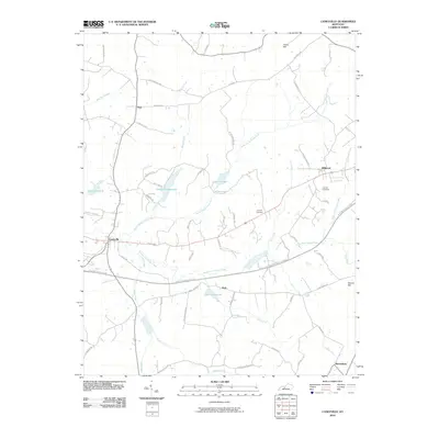
2010 Map of Caneyville
USGS Topo · Published 2010About this map
The town of Caneyville sits at a critical junction of local geography, where the Western Kentucky Pkwy cuts across a landscape defined by the branching tributaries of the Caney Fork. This 2010 survey illustrates a rural Kentucky infrastructure shaped by water management and transit, featuring the Caneyville Reservoir, Lake Number 1, and Lake Number 13. Smaller settlements like Post, Millwood, and Shrewsbury anchor the surrounding countryside, connected by a network of family-named roads such as Choncie Lee Rd and Tommy Ray Rd. The terrain is punctuated by significant elevations like Jones Hill and Hoover Hill, while the Layman Cemetery provides a touchstone for local genealogical research. The mapping of North Caney Creek Fork and South Fork Caney Creek reveals the dendritic drainage patterns that have historically dictated the placement of homesteads and thoroughfares in this portion of Grayson County.
Find a feature on this map
58 named features on this map. Tap any name to fly to it.
Don’t see what you’re looking for? This feature index may not catch every label — zoom into the map to look around manually.
Map Details
Editions of this 2010 Caneyville Map
This is the sole edition of this map. No revisions or reprints were ever made.
Other maps of this area

1922 · Leitchfield
USGS Topo · 1:48,000

1925 · Spring Lick
USGS Topo · 1:62,500

1925 · Leitchfield
USGS Topo · 1:62,500

1932 · Fordsville
USGS Topo · 1:62,500

1953 · Mc Daniels
USGS Topo · 1:24,000

1953 · Ready
USGS Topo · 1:24,000

1953 · Bee Spring
USGS Topo · 1:24,000

1953 · Falls Of Rough
USGS Topo · 1:24,000

1954 · Evansville
USGS Topo · 1:250,000

1954 · Spring Lick
USGS Topo · 1:24,000