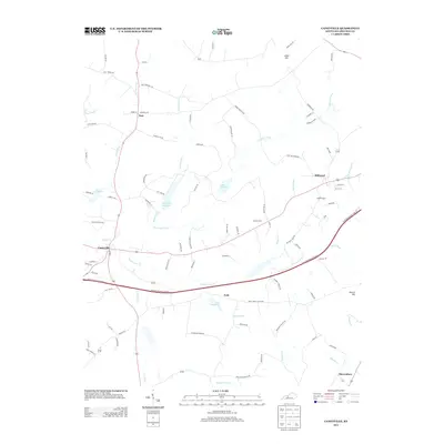
2013 Map of Caneyville
USGS Topo · Published 2013About this map
Caneyville serves as the primary hub of this Grayson County landscape, situated at the confluence of several branches of Caney Creek and the southern edge of the Caneyville Reservoir. The terrain is defined by a dense network of waterways, including the South Fork Caney Creek and North Caney Creek Fork, which have shaped the settlement patterns of outlying communities like Millwood, Peth, and Post. The Western Kentucky Parkway bisects the region, providing modern transit across a landscape dotted with local landmarks such as Jones Hill and Hoover Hill. Local history is preserved in the location of the Caney Creek Church and Layman Cemetery, while the presence of several numbered lakes, such as Lake Number 1 and Lake Number 13, points to the managed water systems crucial to the area's agricultural and local infrastructure.
Find a feature on this map
93 named features on this map. Tap any name to fly to it.
Don’t see what you’re looking for? This feature index may not catch every label — zoom into the map to look around manually.
Map Details
Editions of this 2013 Caneyville Map
This is the sole edition of this map. No revisions or reprints were ever made.
Other maps of this area

1922 · Leitchfield
USGS Topo · 1:48,000

1925 · Spring Lick
USGS Topo · 1:62,500

1925 · Leitchfield
USGS Topo · 1:62,500

1932 · Fordsville
USGS Topo · 1:62,500

1953 · Mc Daniels
USGS Topo · 1:24,000

1953 · Ready
USGS Topo · 1:24,000

1953 · Bee Spring
USGS Topo · 1:24,000

1953 · Falls Of Rough
USGS Topo · 1:24,000

1954 · Evansville
USGS Topo · 1:250,000

1954 · Spring Lick
USGS Topo · 1:24,000