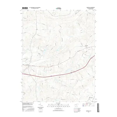
2016 Map of Caneyville
USGS Topo · Published 2016About this map
Caneyville serves as the primary hub in this portion of Grayson County, where the convergence of the Caney Creek and its various forks has long dictated the layout of local infrastructure. The terrain is characterized by a dense network of watercourses, including the North Caney Creek Fork and South Fork Caney Creek, which wind through a landscape dotted with small rural settlements like Millwood, Peth, and Post. The presence of the Caneyville Reservoir and numbered lakes suggests a managed hydrological landscape, while family-named features like Jones Hill and Hoover Hill reflect the deep-rooted local history of the region. Genealogists and historians will find interest in the documented locations of the Layman Cemetery and the dispersed road network connecting long-standing communities like Shrewsbury to the larger transportation corridors.
Find a feature on this map
89 named features on this map. Tap any name to fly to it.
Don’t see what you’re looking for? This feature index may not catch every label — zoom into the map to look around manually.
Map Details
Editions of this 2016 Caneyville Map
This is the sole edition of this map. No revisions or reprints were ever made.
Other maps of this area

1922 · Leitchfield
USGS Topo · 1:48,000

1925 · Spring Lick
USGS Topo · 1:62,500

1925 · Leitchfield
USGS Topo · 1:62,500

1932 · Fordsville
USGS Topo · 1:62,500

1953 · Mc Daniels
USGS Topo · 1:24,000

1953 · Ready
USGS Topo · 1:24,000

1953 · Bee Spring
USGS Topo · 1:24,000

1953 · Falls Of Rough
USGS Topo · 1:24,000

1954 · Evansville
USGS Topo · 1:250,000

1954 · Spring Lick
USGS Topo · 1:24,000