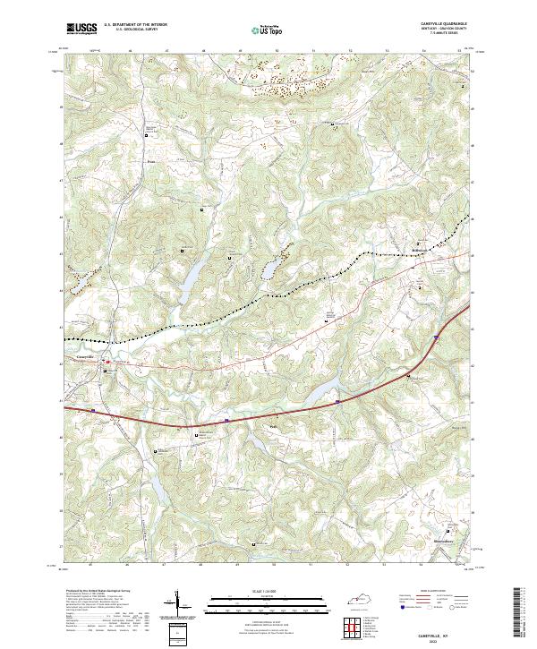
2022 Map of Caneyville
USGS Topo · Published 2022About this map
Caneyville serves as the primary hub of this landscape, situated at the junction of the South Fork Caney Creek and Caney Cr. The settlement patterns here reveal a high density of family-affiliated cemeteries and rural worship centers, such as the Wilson United Baptist Church Cem and the New Hope Baptist Church Cem, which speak to the long-standing genealogical roots of this part of Grayson County. Further east, the small communities of Millwood and Shrewsbury anchor the rural crossroads.
Find a feature on this map
112 named features on this map. Tap any name to fly to it.
Don’t see what you’re looking for? This feature index may not catch every label — zoom into the map to look around manually.
Map Details
Editions of this 2022 Caneyville Map
This is the sole edition of this map. No revisions or reprints were ever made.
Other maps of this area

1922 · Leitchfield
USGS Topo · 1:48,000

1925 · Spring Lick
USGS Topo · 1:62,500

1925 · Leitchfield
USGS Topo · 1:62,500

1932 · Fordsville
USGS Topo · 1:62,500

1953 · Mc Daniels
USGS Topo · 1:24,000

1953 · Ready
USGS Topo · 1:24,000

1953 · Bee Spring
USGS Topo · 1:24,000

1953 · Falls Of Rough
USGS Topo · 1:24,000

1954 · Evansville
USGS Topo · 1:250,000

1954 · Spring Lick
USGS Topo · 1:24,000