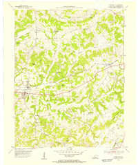
1954 Map of Caneyville
USGS Topo · Published 1955About this map
The town of Caneyville serves as the focal point of this mid-century portrait of Grayson County, situated along the Illinois Central railroad and the banks of Caney Creek. The map reveals a densely settled rural landscape defined by its community infrastructure, particularly its numerous country schools and churches. Educational landmarks like Ned Springs Sch, Stinson Sch, and Byers Sch are scattered across the terrain, reflecting the localized school districts of the era. To the east, the village of Millwood marks another stop on the rail line, while Shrewsbury anchors the southeastern corner.
Find a feature on this map
37 named features on this map. Tap any name to fly to it.
Don’t see what you’re looking for? This feature index may not catch every label — zoom into the map to look around manually.
Map Details
Editions of this 1954 Caneyville Map
This is the sole edition of this map. No revisions or reprints were ever made.
Other maps of this area

1922 · Leitchfield
USGS Topo · 1:48,000

1925 · Spring Lick
USGS Topo · 1:62,500

1925 · Leitchfield
USGS Topo · 1:62,500

1932 · Fordsville
USGS Topo · 1:62,500

1953 · Mc Daniels
USGS Topo · 1:24,000

1953 · Ready
USGS Topo · 1:24,000

1953 · Bee Spring
USGS Topo · 1:24,000

1953 · Falls Of Rough
USGS Topo · 1:24,000

1954 · Evansville
USGS Topo · 1:250,000

1954 · Spring Lick
USGS Topo · 1:24,000