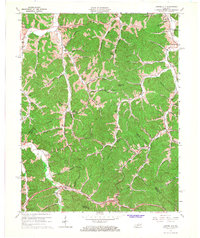
1965 Map of Cannel City
USGS Topo · Published 1967About this map
Cannel City and the surrounding hollows of Morgan and Wolfe Counties are revealed in this detailed study of the Eastern Kentucky coalfields. The landscape is defined by the sharp dendritic drainage of Caney Creek and Grassy Creek, where narrow valleys dictate the placement of small communities and family-named landmarks. The map documents a transition in infrastructure, showing the Parkway cutting through the southern hills with major access points at the Helechawa Interchange and Adele Interchange. Industrial activity is evident through numerous oil wells and gas wells scattered across the ridges, particularly near Pilot Knob. Local life is anchored by rural institutions such as Walters Chapel, Walnut Grove Church, and the dual-named settlements of Salem (Buskirk PO) and Adele (Insko PO), which highlight the historical importance of the post office in these mountain communities.
Find a feature on this map
59 named features on this map. Tap any name to fly to it.
Don’t see what you’re looking for? This feature index may not catch every label — zoom into the map to look around manually.
Map Details
Editions of this 1965 Cannel City Map
3 editions found
Other maps of this area

1889 · Salyersville
USGS Topo · 1:125,000

1891 · Salyersville
USGS Topo · 1:125,000

1899 · Salyersville
USGS Topo · 1:125,000

1950 · Lenox
USGS Topo · 1:24,000

1951 · Cannel City
USGS Topo · 1:24,000

1951 · Landsaw
USGS Topo · 1:24,000

1951 · White Oak
USGS Topo · 1:24,000

1951 · Ezel
USGS Topo · 1:24,000

1951 · Hazel Green
USGS Topo · 1:24,000
1951 · Lenox
USGS Topo · 1:24,000