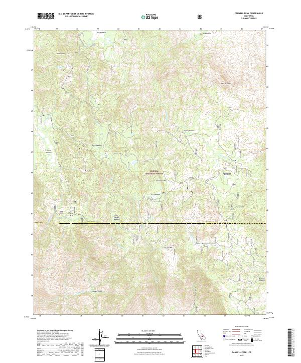
2021 Map of Cannell Peak
USGS Topo · Published 2021About this map
Cannell Peak and the high-elevation meadows of the Sequoia National Forest dominate this landscape along the Tulare and Kern County border. The map documents a classic Sierra Nevada terrain characterized by seasonal grazing lands and water sources, including Big Meadow, Cannell Meadow, and True Meadow. Small settlements like Pine Flat and the humorously named Potato Patch sit among the drainages of Caldwell Cr and Cannell Cr. The presence of several named peaks and domes, such as Church Dome, alongside forest roads like Cherry Hill and Taylor, reflects the region's history of timber management, backcountry recreation, and ranching. The southern portion of the map transitions into Bartolas Country, showing the descent toward the Kern River watershed through Burnt Canyon and across several township lines.
Find a feature on this map
33 named features on this map. Tap any name to fly to it.
Don’t see what you’re looking for? This feature index may not catch every label — zoom into the map to look around manually.
Map Details
Editions of this 2021 Cannell Peak Map
This is the sole edition of this map. No revisions or reprints were ever made.
Other maps of this area

1905 · Fairview
USGS Topo · 1:24,000

1906 · Kernville
USGS Topo · 1:125,000

1908 · Kernville
USGS Topo · 1:125,000

1918 · Fairview
USGS Topo · 1:31,680

1943 · Onyx
USGS Topo · 1:62,500

1943 · Isabella
USGS Topo · 1:62,500

1948 · Bakersfield
USGS Topo · 1:250,000

1955 · Bakersfield
USGS Topo · 1:250,000

1956 · Bakersfield
USGS Topo · 1:250,000
1956 · Kernville
USGS Topo · 1:62,500